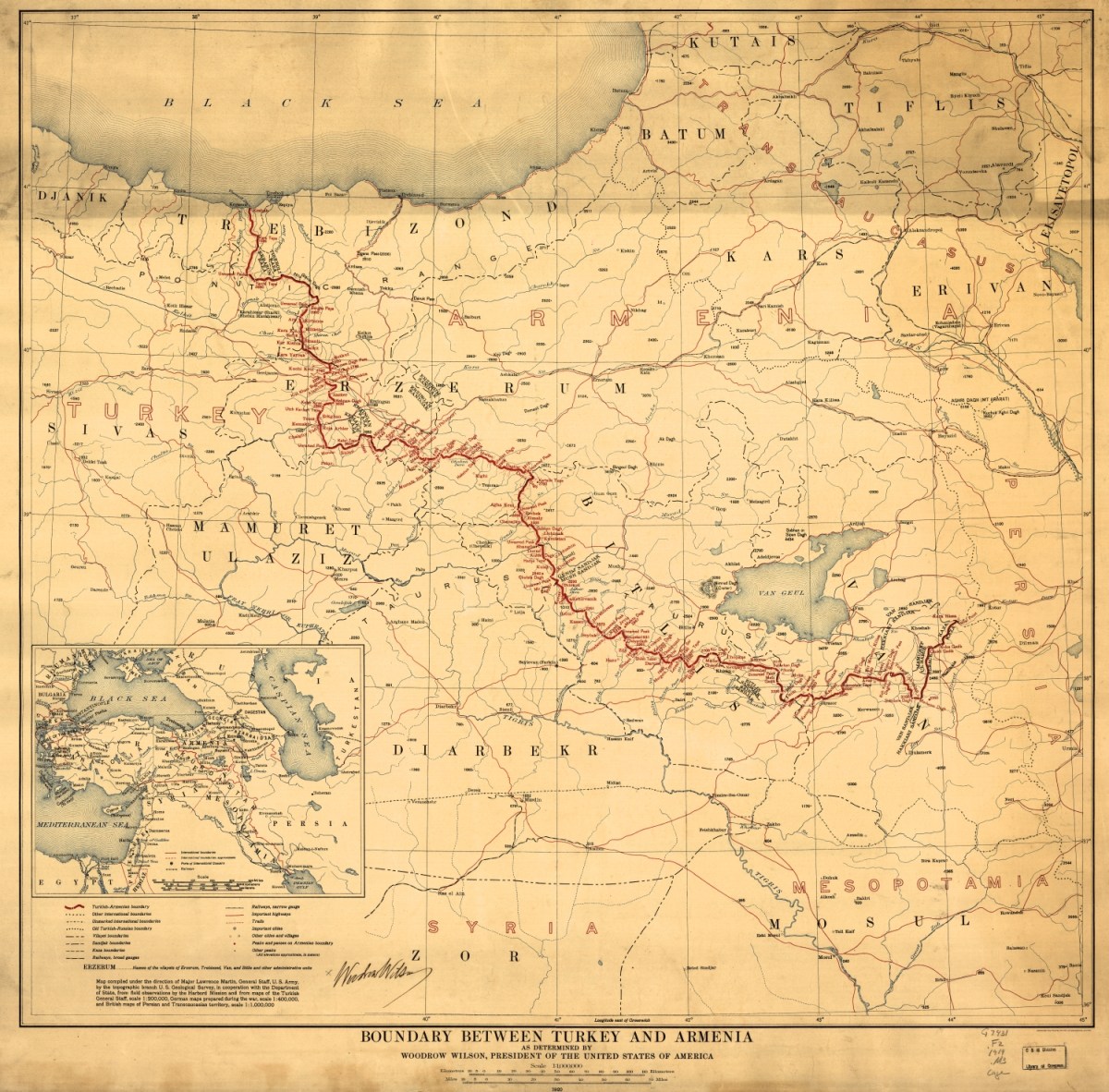
1920 American map of the proposed boundary between Turkey and Armenia determined by US President Woodrow Wilson

Full map

1920 American map of the proposed boundary between Turkey and Armenia determined by US President Woodrow Wilson.
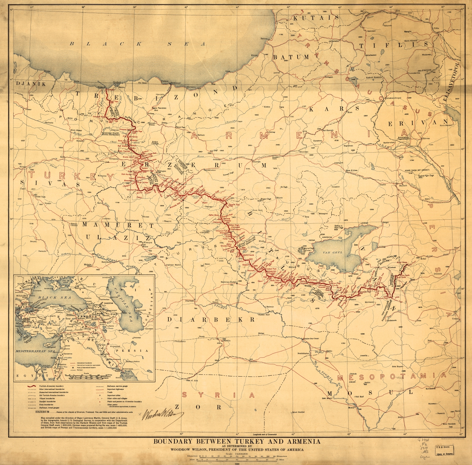
Leave a Reply

Fill in your details below or click an icon to log in:

WordPress.com Logo

You are commenting using your WordPress.com account. Log Out /  Change )

Twitter picture

You are commenting using your Twitter account. Log Out /  Change )

Facebook photo

You are commenting using your Facebook account. Log Out /  Change )

Connecting to %s