1922 British military survey map of the Mount Ararat region

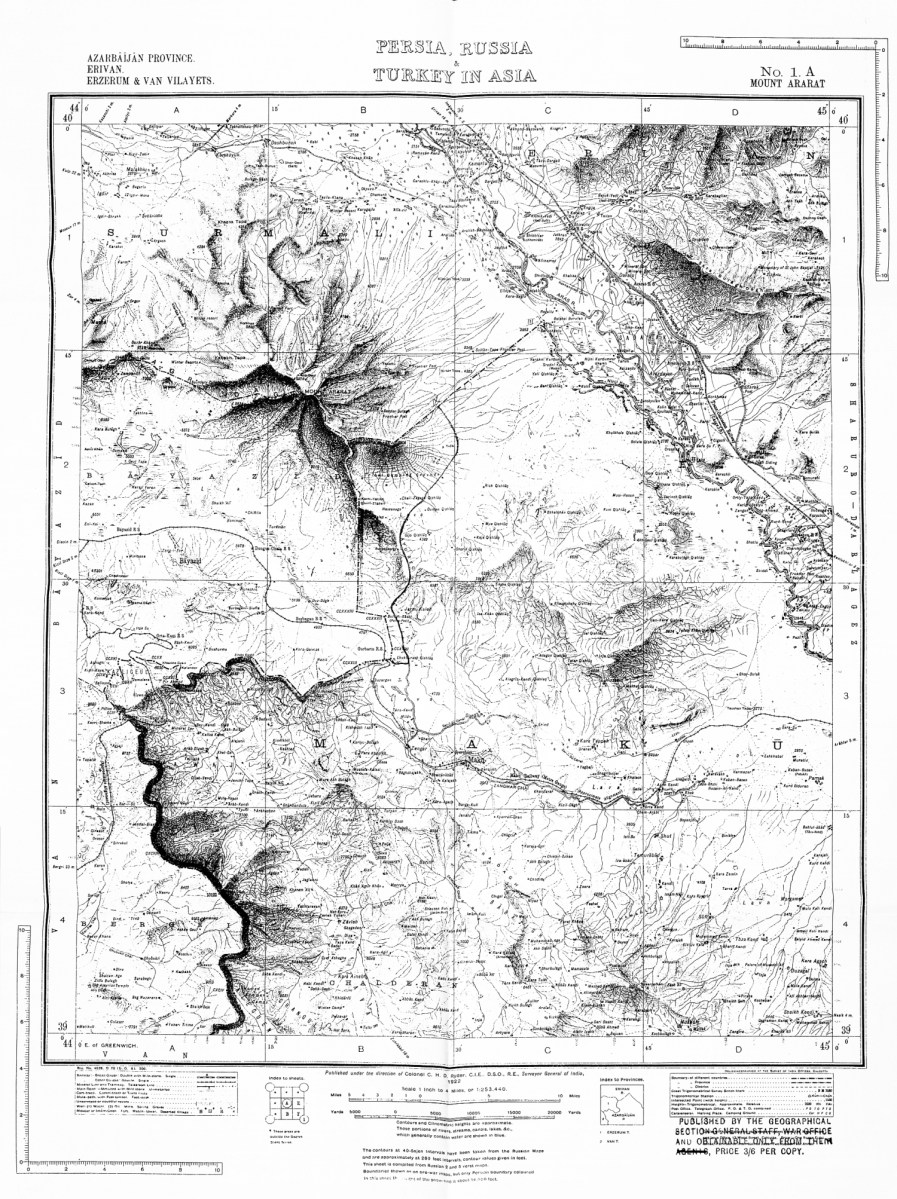
1922 British military survey map of the Mount Ararat region, showing the borders prior to World War I. Notably, the 1932 frontier, placing Lesser Ararat under Turkish administration, was drawn onto this map at a later date. Consequently, both the pre- and post-1932 Turco-Persian borders are illustrated here.

Leave a Reply

Fill in your details below or click an icon to log in:

WordPress.com Logo

You are commenting using your WordPress.com account. Log Out /  Change )

Twitter picture

You are commenting using your Twitter account. Log Out /  Change )

Facebook photo

You are commenting using your Facebook account. Log Out /  Change )

Connecting to %s